Data Scenario: Raster missing geospatial metadata
Data issue
| File Name | Modified |
|---|---|
| dem_without_metadata.tif | 8/2/23, 8:53:13 PM |
| solution-gdal_translate.sh | 8/2/23, 8:53:13 PM |
No matching items
Note
The included data file sample is not a real example of data from NSIDC; it’s been modified from the original (here) to present a challenge.
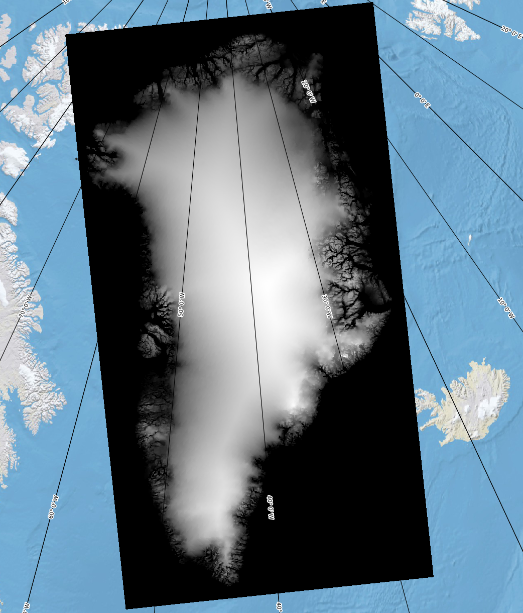
You download a dataset (dem_without_metadata.tif, found in this directory) which doesn’t load as expected in QGIS. When loaded alongside QGreenland, instead of overlaying the DEM on Greenland, it can be found near the North pole using the “Zoom to Layer” feature.
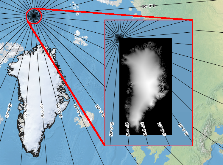
dem_without_metadata.tif displayed along with QGreenlandThe landing page from which you downloaded this DEM states the dataset’s proj4 string is:
+proj=stere +lat_0=90 +lat_ts=71 +lon_0=-39 +x_0=0 +y_0=0 +a=6378137 +rf=298.257024882273 +units=m +no_defsAnd the corner coordinates are:
Upper Left  ( -802500.000, -597500.000)
Lower Right (  702500.000,-3402500.000)
Validation
The dataset should include all of the metadata necessary to correctly position it alongside other layers in QGreenland.